(EGERSUND, Norway) — C-MAP, a leader in digital marine cartography and cloud-based mapping, has launched new high-detail C-MAP Discover and C-MAP Reveal charts for Lowrance, Simrad and B&G chartplotters.
The Discover and Reveal charts include new features like custom depth shading, shaded relief for inland waters, subscription-free easy routing and more. The charts replace Insight Pro, Lake Insight HD, Precision Contour HD, MAX-N and MAX-N+ charts in the C-MAP lineup, greatly simplifying its chart portfolio.
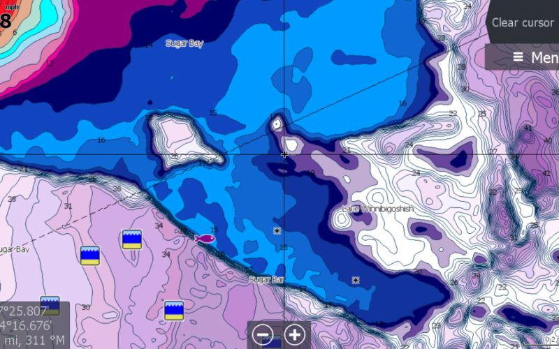
Whether cruising, fishing or sailing, the entry-level C-MAP Discover charts have all the core features needed to make the most of time spent on the water and include coverage for the U.S. and Canada on one card. Discover charts offer full-featured vector charts along with the best of C-MAP high-resolution bathymetry, including integrated Genesis social map data.
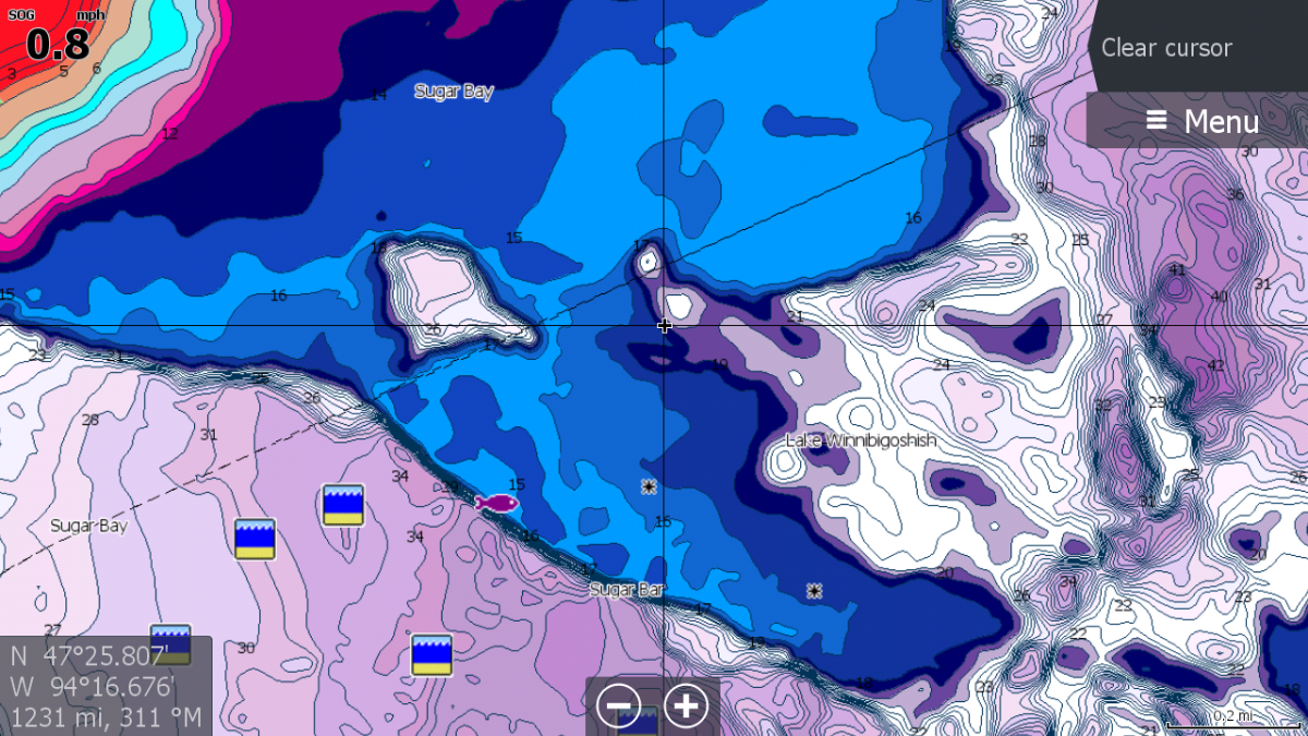
The charts also feature custom depth shading, delivering the highest level of information from underwater pinnacles and ledges to ditches and canyons. Users can set a clear safety depth, or create their own custom shading – a popular feature for fishing. The tides and currents feature provides projections of water level and direction of tides to help plan a day out cruising, fishing or sailing. Subscription-free easy routing automatically plots the shortest, safest route based on chart data and personalized vessel information.
C-MAP Reveal charts include all the attributes of Discover charts, plus other premium chart features highlighted by seafloor and inland shaded relief. With shaded relief, users can view the world like never before with 3D-rendered land and underwater elevation, including areas of ultra-high-resolution bathymetric imagery – a game-changer for anglers and divers.
C-MAP Reveal also offers dynamic raster charts, bringing a traditional paper chart look and feel; and aerial photography, providing an additional level of detail with thousands of photos of marinas, harbors, inlets and other notable navigational features. Reveal’s satellite overlay delivers real-world reference and enhances situational awareness for coastal navigation. C-MAP Reveal charts are available on Reveal lake cards – featuring shaded relief, plus 1-foot contours on more than 15,000 U.S. lakes and over 9,400 lakes in Canada – as well as Reveal coastal cards, which include the popular seafloor shaded relief views of the bottom.
Now available, C-MAP Discover and Reveal charts are priced at $124.99 and $149.99-$249.99, respectively.
Visit www.c-map.com/chartexplorer to see a fully interactive viewer of C-MAP shaded relief.