The El Faro sinking in 2015 that killed 33 mariners might have been averted had the cargo ship been using routing software recently developed by the University of Connecticut engineering department, asserts one of the tool’s developers.
Two years after the incident, which occurred near the Bahamas, the U.S. Coast Guard concluded in October that El Faro’s captain had underestimated the power of Hurricane Joaquin, overestimated his ship’s strength and should have rerouted.
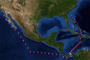
UConn graduate student David Sidoti analyzed conditions faced by the El Faro crew and, using the Tool for Multi-objective Planning and Asset Routing (TMPLAR), he and fellow researchers found eight possible safe routes that involved strategies like laying up at waypoints and varying the ship’s speed. UConn engineering Professor Krishna Pattipati was the lead developer of the software.
A year before the El Faro tragedy, the U.S. Navy sought UConn’s help in developing better routing tools, said Sidoti, a research assistant who is finishing up his doctorate in combinatorial optimization — a branch of engineering and other disciplines that develops optimal approaches for the most complex problems.
The Navy previously had worked with UConn’s staff to tackle issues related to ship piracy and drugs, and it hoped it also could create algorithms to more effectively route ships, Sidoti said.
He explained the need: Say a ship is heading from Norfolk, Va., to the Strait of Gibraltar, where a severe storm is predicted at the ship’s arrival time. The Navy navigator knows the storm might not materialize as forecast or could move out of the ship’s path, so it’s tempting to head straight toward the destination and reroute later if necessary. But currently used software often recommends routing around the storm from the start. That leads to wasted fuel and increased downtime for crews.
“And it means that the human knows better than the software and can’t trust it in certain situations when it probably matters most,” Sidoti said.
TMPLAR suggests routes that are more in tune with how human decision-makers might plan a voyage, he said.
Navy officials hoped UConn’s tool could cut fuel costs by 4 percent to 5 percent, but estimates during extensive testing show savings may wind up being around 33 percent, Sidoti said.
Here’s how TMPLAR works: Using a Web interface, a navigator enters a start date and time and a desired arrival date and time, then plugs in an array of known and unknown variables for the voyage.
“What the tool does is factor in everything between your starting point and end point,” Sidoti said. “How deep is the ocean between the points? Is there a shallow part to work around? How many waypoints are there? Is there an island in the path? What are the minimum and maximum speeds the ships are required to go? Weather complicates things further. What is the true wind? Where is the nearest tropical cyclone? You also have to consider things like ocean heights, swells, currents and so on. All such things are factored in to create the best possible route.”
Navy officials are optimistic about the software’s impact.
“TMPLAR is poised to leverage weather forecasts and other mission constraints to provide Navy decision-makers a platform to obtain optimized guidance to aid in the distribution and routing of fleet assets to best meet complex mission needs and improve resource efficiency,” said Victor Chen, a public affairs officer for the U.S. Naval Research Laboratory in Monterey, Calif.
The lab is still in the demonstration and collaboration phase of developing the software, Chen said. No deployment date has been set, but TMPLAR has already been fully integrated with the Navy’s oceanographic weather forecasts.
“It’s a major problem for the Navy trying to tackle the uncertainties and exploit them, like using time at a waypoint to conduct training exercises to still be efficient,” Sidoti said. “This tool will help to do that.”