The National Oceanic and Atmospheric Administration (NOAA) will cease production of traditional paper nautical charts within five years, a move that reflects falling demand from commercial and recreational mariners.
NOAA, which announced the change in November, will begin phasing out paper and raster chart products by 2021 and fully shut down the program by Jan. 1, 2025. In the meantime, the agency is working to enhance its suite of electronic navigational chart (ENC) products that will replace the paper charts.
After 2025, mariners will still have access to paper charts printed on demand through approved third-party vendors, or through the online NOAA Custom Chart (NCC) application. The charts will be printed from NOAA ENC data, which will change the appearance and some of the data displayed on the printed product.
Capt. Chris van Westendorp, chief of NOAA’s Navigation Services Division within the Office of Coast Survey, is among the officials leading the transition. He said it would allow NOAA to focus its resources on a single product rather than two separate formats.
“By ‘sunsetting’ the raster chart process and moving to all ENCs … we are going to be increasing the number of available charts eightfold,” he said in a recent interview, suggesting the number of ENCs will jump from about 1,200 now to nearly 9,000 in the coming years.
The new ENC charts will offer higher resolution and better scales, among other improvements, van Westendorp said. They also will incorporate corrections much faster than paper charts and eliminate the need for hand updates.
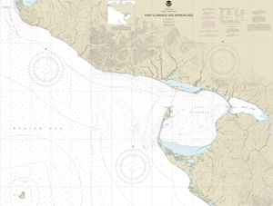
Paper navigational charts have been a mainstay aboard recreational and commercial vessels since the mid-1800s when the Coast Survey Office released its first chart of New York Harbor. These days, NOAA maintains about 1,000 paper charts covering 95,000 miles of ocean coastline and the Great Lakes.
The paper charts are a mix of art and science. Color and ink are used to identify depths, hazards, shipping lanes and other key details. Raster charts can be viewed electronically, albeit with the same limitations as a paper chart. ENCs use digital data in a similar presentation as a traditional paper chart but with much more information available to the user.
Demand for paper charts has fallen sharply over the past decade due to changing regulations and the rise of new technology. NOAA stopped printing charts itself in 2014 and instead turned to third-party vendors. Most modern commercial vessels now have satellite links, electronic chart readers or powerful electronic chart display and information systems (ECDIS). Recreational mariners now can navigate using smartphone or tablet apps.
Capt. Morgan McManus, master of the training ship Empire VI at SUNY Maritime College, said NOAA’s decision to sunset paper and raster charts effectively acknowledges what is already happening within the industry. The generation now training to become mariners grew up with screens and they are accustomed to that type of interface.
“I love paper charts, but this generation coming up, they are used to a digital platform,” McManus said. “I was with students on the training ship this past summer and they are so comfortable around a screen. The digital platform is comfortable for them. Do you try to fight that tendency?”
The training academies will continue teaching navigation using paper charts because, for now anyway, that is the format of Coast Guard exams. However, McManus noted that digital technology offers benefits compared to plotting on paper.
“When you put a position on a paper chart, you’re showing where you were, not where you are going,” he said. “When you are using an ECDIS display, you see where the ship is going a lot better than on a paper chart. Why wouldn’t we want to embrace that technology for better navigation and safer watch-standing?”
Captain’s Supplies, a chart house and marine outfitter in Seattle, addressed the transition in a recent blog. In short, the company said, the change will have a limited effect considering mariners will still have access to on-demand paper charts.
“NOAA is discontinuing one of two digital formats they provide chart data in,” the post said. “Print-on-demand charts will still be available, using the other digital format, from Captain’s and from other providers of NOAA charts.”
NOAA is seeking feedback through Feb. 1 on its plan to cease paper and raster chart products. As of late November, sentiment about the proposal was mixed, van Westendorp said. Comments can be posted via the following link: nauticalcharts.noaa.gov/customer-service/assist/.